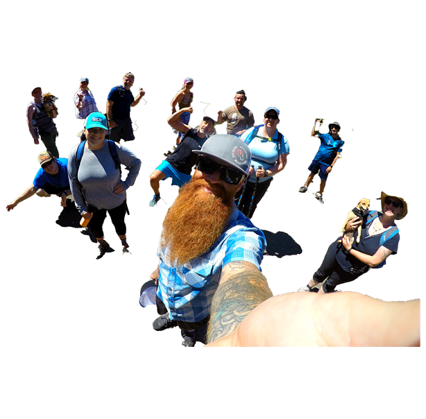
R) Gorgeous climb up to 9,025 ft
U) Crystal clear Middle Deadfalls Lake
S) Mt. Eddy, tallest mountain west of I-5
H) Social vibe, solid workout, all welcome
MORE ‘DIVE IN‘ DETAILS BELOW:
The Rushmore Society, your Social Adventure Network of Very Busy People, invites all go-getters to take on the doable challenge of Mt. Eddy, the tallest mountain west of I-5.
It’s our SIGNATURE ADVENTURE EVENT of the MONTH!
A quick 90 minutes south, the moderate to strenuous hike to the top of Mt. Eddy rewards us amazing easterly views of Mt. Shasta, and a gorgeous pit stop at mile point 3.5 of our jaunt, Middle Deadfalls Lake, with its breathtakingly pristine high lake waters. RSVP NOW.
ALL BASIC DETAILS BELOW:
WHO: Adventurous social networkers
CARPOOL MEET TIME: 8:15am
DEPARTURE TIME: 8:35am
RETURN: 6:30pm
CARPOOL MEET: Luna Cafe, ex. 14
BRING: Lunch, water (LOTS), sunscreen, camera, hat
POST HIKE EATS: Yaks on the 5
HIKE: 10 miles & 2,500 ft elevation gain
HIKE DIFFICULTY: Moderate to strenuous
HIKE DETAILS:
Mt. Eddy is a doable challenge. Getting to the top is well worth the effort. No expert climbing skills are needed. Reasonable shape and proper previsions are essential. If you don’t make it all the way, three lakes dot the trail from start to finish.
MORE HIKE DETAILS:
From the trailhead, look for Pacific Crest Trail (PCT) signs leading south and initially paralleling the chip-sealed Parks Creek Road. The PCT (hikers and equestrians only) stays mostly level at the onset and soon provides views of the Trinity Alps from a northeast vantage point. Red fir and white fir mix with Jeffrey pine and ponderosa pine to shade patches of dwarf larkspur and yarrow as you travel to a seasonal creek at 1.1 miles. Another stream gurgles down to scenic Deadfall Meadows at 1.8 miles, where yellow lupine and white-flowered angelica combine with sage for showy trailside color. The wildflower displays keep coming, with corn lily and red columbine surrounding another brook at 2.1 miles.
Western white pine dominates at 2.2 miles as you first sight Mount Eddy’s southwest shoulder, along with the upper meadows where Deadfall Creek meanders. Reach a trail sign mounted on a huge western white pine at 2.6 miles. A right here would quickly lead you to Lower Deadfall Lake, which has a few campsites but loses a lot of water by late summer. Focus your attention on the prettier lakes farther on by going left and continuing uphill on the Sisson–Callahan Trail.
You soon spot Middle Deadfall Lake on the right. Big rocks on the shoreline make great sunbathing and dipping spots, and you’ll also find several campsites. A marsh covered with marigolds empties into Middle Deadfall Lake’s north side. Rejoin the Sisson–Callahan Trail near this colorful marsh, and then wander past a pure stand of western white pine on your way to Mount Eddy.
At 3.1 miles, just before the first of three alpine ponds, foxtail pines appear. Three superb campsites exist at the first pond, which reflects the orange metamorphosed rock of the west flank of Mount Eddy. Reach the meadow above Upper Deadfall Lake at 3.6 miles. A sand-bottomed brook wanders through the meadow, where wild onion, buttercup, and bird’s-foot grow next to a spring. The path ascends to the southwest, allowing numerous views of the Deadfall Lakes and the Trinity Alps in the distance.
At 4.2 miles you reach Deadfall Summit. Go left at a trail fork and climb relentlessly for the next 0.8 mile, gazing at displays of the upper Sacramento River drainage to the east and Castle Crags to the southeast, as well as a mix of shiny metamorphic stones and alpine wildflowers at your feet. An excellent vista of Mount Shasta awaits at Mount Eddy’s summit. In addition to all previously encountered views, you’ll also see Black Butte.
MORE ABOUT MOUNT EDDY:
Mount Eddy honors Olive Paddock Eddy, the first woman to climb Mount Shasta. She and her husband, Nelson Harvey Eddy, moved in 1856 from New York to far Northern California, where he became a successful Shasta Valley rancher. It’s believed the mountain’s original name might have been Num-mel-be-le-sas-pam, or “west blaze mountain,” by Wintu Indians.
For trivia fans, Mount Eddy is the tallest mountain in the United States west of Interstate 5. Depending on the source, Eddy’s summit is listed as 9,025 or 9,037 feet, while the elevation gain from the trail is variously listed as 2,170 to 2,850 feet at different sources.
Only scattered remains of a lookout, which operated until 1931, exist on the summit. According to the Aug. 5, 1920, Bakersfield Californian, J.S. McClemmons was on the telephone at the lookout when lightning struck the building, blowing a 4-foot hole in the wall and, ironically, setting the structure on fire. McClemmons was initially knocked unconscious but recovered quickly enough to put out the fire. He then hiked to Sisson, now Mount Shasta City, where he was treated for burns and released.
DRIVING DIRECTIONS:
Drive south on Interstate 5, 3.4 miles beyond the Weed turnoff, and take exit 751 Edgewood/Gazelle. Go under the freeway, turn right at the stop sign, and after 0.3 mile turn left onto Stewart Springs Road. At 4.7 miles turn right onto Forest Road 17, also known as Parks Creek Road. Park at the large trailhead clearing at Parks Creek Pass, 13.7 miles from the freeway exit.
The Rushmore Society is Southern Oregon’s premiere real life social network of very busy people in search of Adventure, Connection and Play. Do More, Live More, Rushmore. Join us this summer!


