6 AM UPDATE: A RED FLAG THUNDERSTORM WARNING HAS MADE HIKING LAKE HARRIETTE UNSAFE. IF YOU ARE NOT ON FACEBOOK, PLEASE EMAIL THE SOCIETY FOR AN ALTERNATIVE HIKE ITINERARY ?
?2019 AUGUST HIKE SERIES?
LOOK OUT HARRIETTE LET’S GO
?GET FIT – CONNECT – EXPLORE?
SPECIALLY DESIGNED SMOKE-FREE
We know smoke can get us all down, which is why we’ve developed our August Hike Series specifically in areas that are LESS LIKELY to have smoke — think high up, near lakes. See all our August Hikes and check out all our other SMOKE-FREE upcoming events HERE.
WHY MEMBERSHIP MAKES SENSE
WE PROVIDE EVERYTHING YOU NEED:
?Thirty-Two Hikes April thru November
?Carpooling – Maps – Hike Difficulty Rating
?Evenings & Weekends – Doggie Info
?Perfect Picture Spots – Post-Hike Fun
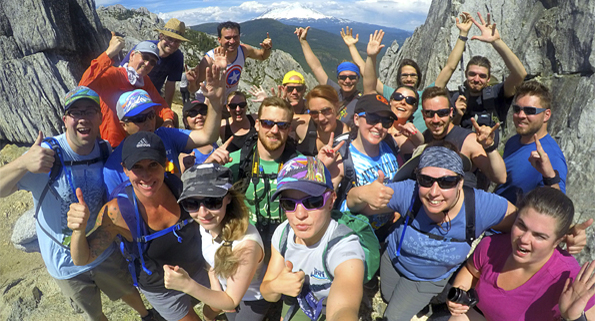
?Cool People – Rad Concept – Positive Vibes
Learn what everyone is raving about, and try a whole month on us for FREE using the code “HikeRush2019” when you check out at membership!
RUSHMORE HIKE BASICS:
WHO: All welcome / MEMBERSHIP DETAILS ABOVE
VIBE: Social — Positive — Fun
WHAT TO BRING: Lunch – Water – Camera – Smile – Sunscreen – Hat – Good Trail Shoes
LAKE HARRIETTE SPECIFICS:
CARPOOL POINT: Luna Cafe / 9 am
HIKE DEPARTURE: 9:15 am
ESTIMATED RETURN: 4:00 pm
DIFFICULTLY RATING: mod-hard / 11 miles
DOGS: Yes, doggies are allowed
RSVP ON FACEBOOK RIGHT HERE
HIKE DESCRIPTION:
HARRIETTE IS RATED “M-C” FOR MODERATELY CHALLENGING, and covers 11 miles with 1,200 ft elevation gain.
Varney Creek Trail to Lake Harriette is an 11 mile, lightly trafficked out and back trail located near Klamath Falls, Oregon.
What are the rewards of hiking the Varney Creek Trail, the most popular route that accesses the Mountain Lakes Wilderness?
Pleasantly, it’s a 4-1/2 mile trail that passes through shady pine forests, gradually gaining elevation as it works its way to, across and then alongside to its mostly hidden namesake creek, and then continues south to its junction with the Mountain Lakes Loop Trail. Ed and Zeb lakes are a short distance to the north while two larger, prettier rewards, Como and Harriette lakes, are southeast of the junction.
While the Varney Creek Trail isn’t wildly scenic, it has its moments, especially a “miracle mile,” where the trail is seasonally flanked by meadows and rocky fields bursting with wildflowers. This time of year it’s colored with amazingly abundant red-hued splashes of paintbrush and scarlet gilia and dabs of purple thread leaf daisies.
But on a sunny, warm day, the ultimate reward is a swim in Lake Como, floating lazily on the back taking in views of Whiteface Peak and Aspen Butte.
Como, slightly more than a half-mile from the loop junction, is one of Mountain Lakes 20 or so lakes. At seven acres it’s the area’s third largest. Another mile or so up the trail is dazzling Lake Harriette, often rightly proclaimed “The Queen of Mountain Lakes” because of its size — nearly 36 acres — and setting.
DRIVING DIRECTIONS FROM LUNA:
New Places, Fresh Faces, RSVP RIGHT HERE!
The Rushmore Society is your premiere real life social network of very busy people living life to the fullest with Adventure, Connection and Play. Do More, Live More, Rushmore.


