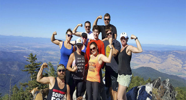
R) Gorgeous climb up to 7,140 ft
U) 360* views of our highest peaks
S) Signature Adventure Event of August
H) Social vibe, great workout, all welcome
ALL ‘LOOK OUT‘ DETAILS BELOW:
The Rushmore Society, your Social Adventure Network of Very Busy People, invites all go-getters to take on the doable challenge of Wagner Butte, one of our best local hikes!
Our SIGNATURE ADVENTURE of the MONTH!
Gaining almost 2000ft in 5 miles, the trail wonders through meadows and forests as it climbs its way to the top of Wagner Butte. At 7140ft, the top of Wagner Butte offers a magnificent 360° view of the Rogue and Applegate Valleys. On clear days, Mt. Shasta and Mt. McLoughlin are both visible on the horizon.
COMPLETE BASIC DETAILS:
WHO: Adventurous social networkers
VIBE: Positive, supportive, always cool
CARPOOL MEET TIME: 8:15am
CARPOOL MEET: Pumphouse Burgers, Talent
DEPARTURE TIME: 8:40am
RETURN: 6:00pm
HIKE DETAILS:
BRING: Lunch, water, sunscreen, camera, hat
POST HIKE EATS: Brats and potato pancakes
HIKE: 10 miles & 2,180 ft elevation gain
HIKE DIFFICULTY: Strenuous but achievable
FULL HIKE DESCRIPTION:
Wagner Butte is a doable challenge. Getting to the top is well worth the effort. No expert climbing skills are needed. Reasonable shape and proper previsions are essential.
While not overly strenuous, the Wagner Butte Trail continually gains elevation. The trail starts with some switchbacks and merges with an overgrown forest service road. It continues with the old road, meandering through the forest and meadows, until it comes to the Sheep Creek Slide.
This is an open area created by a severe thunderstorm in 1983 that set off a debris avalanche. From here, the trail continues gaining elevation and traversing SSE until it comes to Wagner Glade. At the glade, the trail switchbacks and continues on for another 2 miles of rolling terrain to the top. The Wagner Butte Trail ends on a rocky mound that was home to a fire lookout station until 1971. Now, the flat area where the lookout once stood provides amazing view to visitors.
RSVP NOW, RIGHT HERE!
DRIVING DIRECTIONS:
From Pumphouse, at the first light in Talent, turn Left onto Rapp Road. After a mile, Rapp Road turns into Wagner Creek Road. Continue on Wagner Creek Road. After a couple miles, Wagner Creek Road turns to gravel.
About 2.4 miles past the pavement, the road forks. Take the left fork. This will go past a clear cut area at 0.5 miles and then over a cattle guard at 1.4 miles.
Just after the cattle guard is another fork in the road. Take the left fork.
The trailhead is about 2.1 miles past the fork/cattle guard. There will be a large parking area on the right and a sign for the trail on the left.
That’s it, another sweaty, fun adventure from the Rushmore Society.
RSVP RIGHT HERE.
The Rushmore Society is Southern Oregon’s premiere real life social network of very busy people climbing through life with Adventure, Connection and Play. Do More, Live More, Rushmore.


